
Explore FishHawk Ranch
Miles of recreational trails wind throughout FishHawk Ranch, connecting neighborhoods, parks, natural areas and other community destinations. Whether you’re heading out for a morning run, an afternoon bike ride or a leisurely walk beneath the oak canopy, the trail system offers plenty of ways to explore the community outdoors.
Find Your Route
The trail network includes paved paths and boardwalks that pass through wooded areas, alongside ponds and preserves, and through many of FishHawk Ranch’s neighborhoods. Individual mapped routes range from 1.8 to 3.1 miles, with options ranging from shaded nature walks to routes designed for a more challenging run or ride.
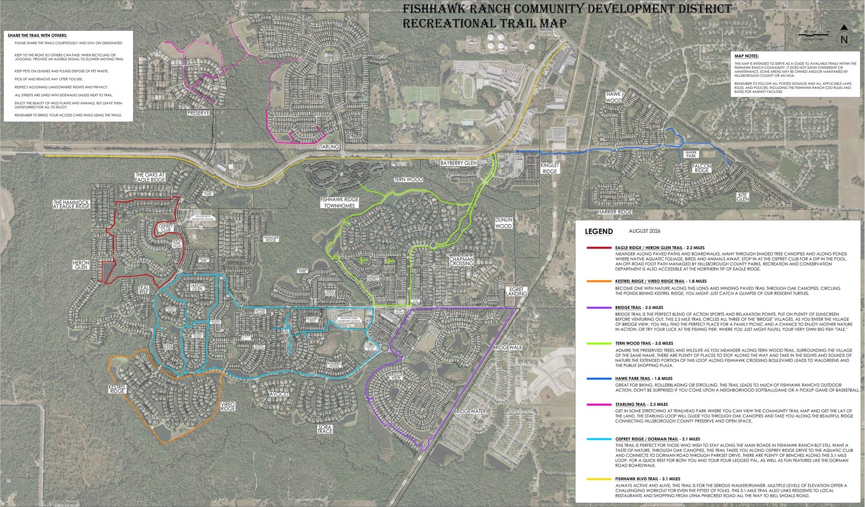
The FishHawk Ranch Recreational Trail Map highlights eight routes throughout the community:
- Starling Trail — 2.3 miles
- Hawk Park Trail — 1.8 miles
- Eagle Ridge / Heron Glen Trail — 2.2 miles
- Kestrel Ridge / Vireo Ridge Trail — 1.8 miles
- Tern Wood Trail — 3.0 miles
- Osprey Ridge / Dorman Trail — 3.1 miles
- Bridge Trail — 2.5 miles
- FishHawk Blvd Trail — 3.1 miles

Share the Trail
- Stay on designated trails.
- Keep to the right to allow others to pass.
- Give an audible signal when passing while biking or jogging.
- Pets should remain leashed and pick up pet waste.
- Pick up and remove any litter you see.
- Please respect neighboring properties privacy.
- Leave plants and wildlife undisturbed.
- Remember to bring your access card when using the trails.

About the Trail Map
This map is provided by the FishHawk Ranch Community Development District (CDD) as a guide to recreational trails throughout FishHawk Ranch. Trail ownership and maintenance responsibilities vary; some areas shown may be owned or maintained by Hillsborough County or an HOA. Please follow posted signage and all applicable CDD rules, policies and other regulations while using the trails.